
| Project Information |
| History |
| Mainstreeter |
| Churches |
| Scholasticate |
| Schools |
| Railways |
| Notables |
| After 1907 |
| 1901 Snapshot |
| Air Photo Study |
| Image Library |
| Databases |
| Search |
|
1956 Fire Insurance
Map Index
|
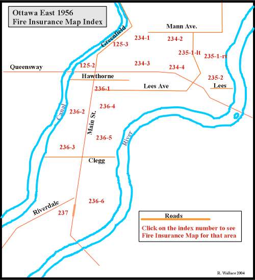
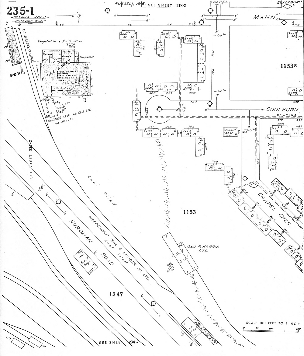
| As with the 1901 Snapshot view of Ottawa East, the 1956 Fire Insurance Maps have been provided for a detailed look at the development of the community. This particular version was produced by the Underwriters' Survey Bureau Limited for use by insurance agencies in establishing the insurance risk when selling policies. |
| The map below has hotlinks to the map sections identified in RED. Simply hold the cursor on the index number and a cue card will appear revealing the file name. Clicking on the index number will bring up a large view of the map section. Please note, some browsers will load a reduced view of the image. Therefore when the image appears hold the cursor over the image until the enlargement button appears and then click that button for a full view. |
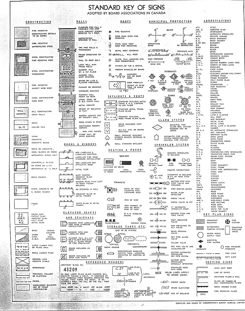
| The original maps were coloured to identify various types of buildings. Unfortunatley the cost of reproducting colour was prohibitive so the maps are in black and white. However if you go the map symbols index located here, it should be a relatively easy task to decipher the various codes without the colour. |
| If all else fails, use the hotlinked index found below the map or open the image in your own graphics software for much more flexibility.. All of the maps are found in the Image Library/Maps/Fire Insurance Maps/1956 Fire Insurance Maps. Have Fun! |
|
Map Index for hotlinks on the map
|
|