
| Project Information |
| History |
| Mainstreeter |
| Churches |
| Scholasticate |
| Schools |
| Railways |
| Notables |
| After 1907 |
| 1901 Snapshot |
| Air Photo Study |
| Image Library |
| Databases |
| Search |
|
Fire Insurance Maps
|
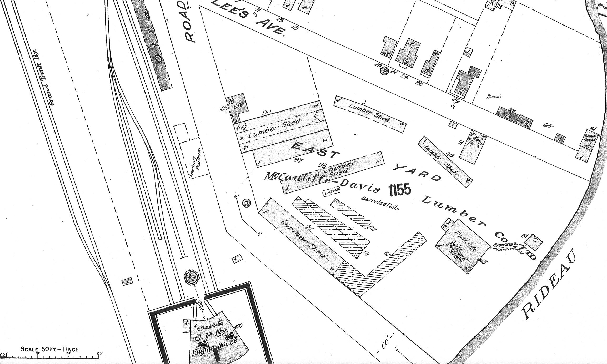
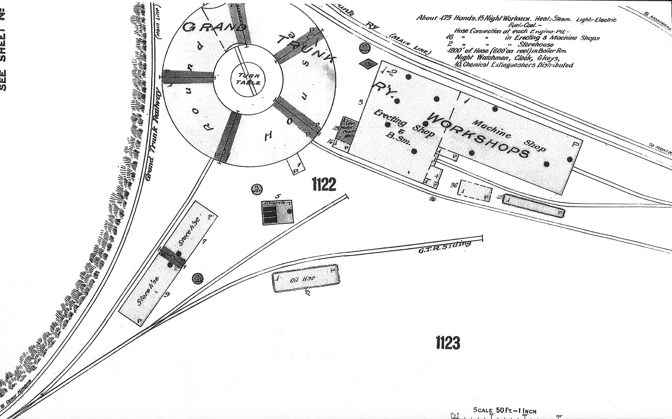
| The "Fire Insurance Maps" are excellent resources for examining the historic detail of an area. The Charles E. Goad Company originally drew these maps for use by insurance companies when estimating insurance rates for a building. As shown in the key found here variables such as building materials and the proximity to hazards such as lumberyards were factored into the cost the insurance. |
| Very few of the original maps survive because of the company policy that required older versions to be destroyed when up-to-date maps were purchased. The National Map Collection holds several versions including the 1901 and 1912 maps for the Ottawa area. The 1912 version shown below is 'apparently based' on research done in 1902 and therefore fits into the 1901 Snapshot of Ottawa East. It may not be exact in terms of some business names in 1901 but this has been corrected in the year description using the census and the municipal directory. The 1901 maps were not used because the collection for Ottawa East is incomplete. |
| The original maps were coloured coded to signify different building types and are available on fiche from the National Map Collection. The cost for purchasing colour reproductions was too prohibitive for this project! With a little inductive thinking the viewer will be able to understand the grey shading. |
| The 1956 Fire Insurance Maps are complete and linked from this page. |
| A large thumbnail of the top and bottom parts of each map can be found below. Find the area of interest and simply click on the map and you will go to a very large scan of the map. The maps are very large and this is deliberate, as the detail would be lost if sized any smaller. |
| Alternately, you can go to the Air Photo and Fire Insurance Map Index. This is a hotlinked map showing the approximate area covered by the map. Click on the T (Top) or the B (bottom) for each symbol and you will be magically transported to that very large map. |
|
1912 Fire Insurance Maps (based on 1902
information)
|
|
 |
 |
 |
 |
 |
 |
 |
 |
 |
 |
 |
 |
 |
 |
